Tropical chances diminish for repeat of Alberto in southwestern Gulf of Mexico
Whether or not the disturbed area of weather develops, the system will produce additional rounds of heavy rainfall for northeastern Mexico and South Texas in the week ahead. The Central America Gyre, commonly referred to as the CAG, continues to be active and has led to at least three areas of disturbed weather, including Tropical Storm Alberto.
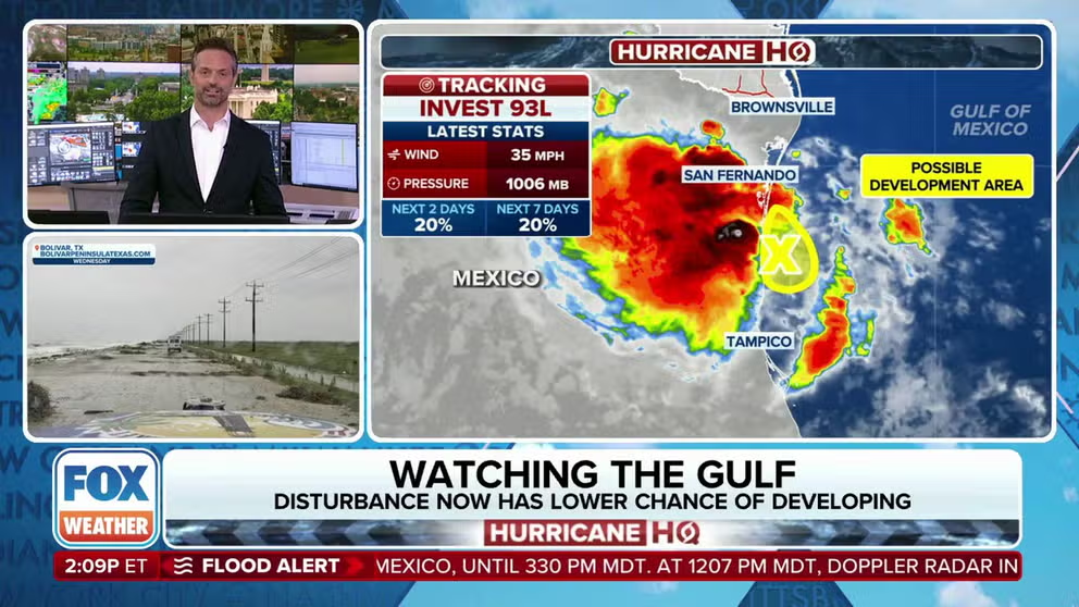
Chances of development drop for Invest 93L
The likelihood that Invest 93L will become a stronger tropical system are decreasing even more Sunday.
The FOX Forecast Center is closely monitoring southeastern Mexico and the southwestern Gulf of Mexico for the development of a tropical disturbance that could affect the same areas impacted by Tropical Storm Alberto last week.
At the last report from the National Hurricane Center, the broad area of circulation has a low chance of development as atmospheric conditions may not be as conducive as they were for Alberto.
The disturbance, known as Invest 93L, is also expected to travel farther south than the first named cyclone of the season, which would limit its effects on Texas.
"If there's a pocket of reasonably conducive atmosphere, even though this is a large swirl, big in diameter, it will be slow to consolidate," FOX Weather Meteorologist Ian Oliver said. "It will have an opportunity to do just that moving through the weekend."
(FOX Weather)
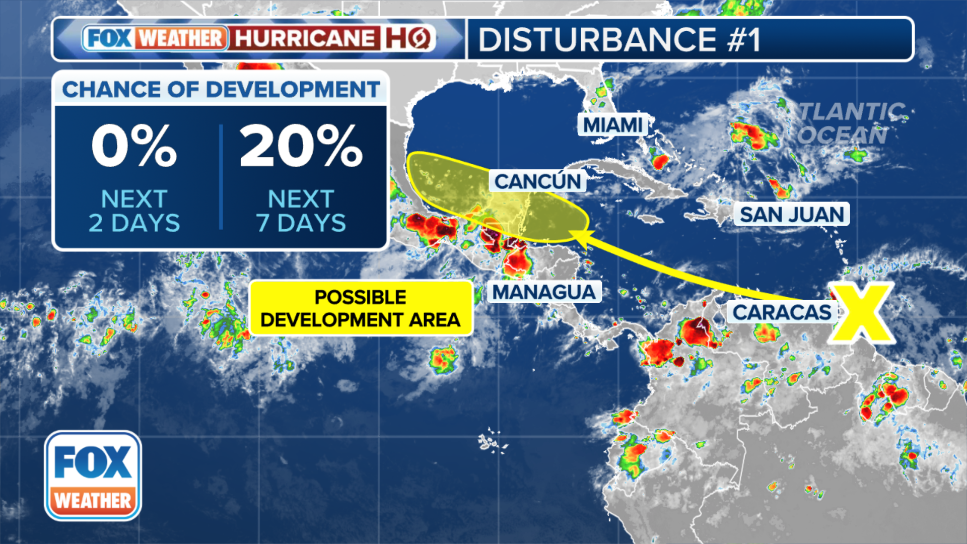
Active Central American Gyre fueling tropical activity
A phenomenon known as the Central American Gyre has been primarily responsible for producing systems such as Tropical Storm Alberto and Invest 90E in the Eastern Pacific.
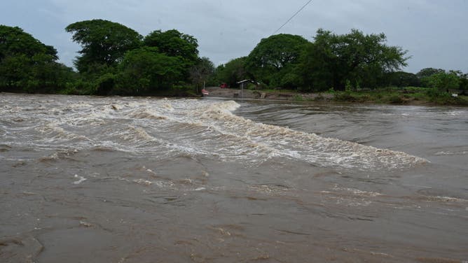
Since June 11, NOAA satellites have estimated that more than 2 feet of rainfall has occurred over countries such as El Salvador and Guatemala, leading to flooding and mudslides.
At least two dozen people have been killed, as local authorities warn of additional threats from landslides.
Almost every hurricane season sees the formation of at least one CAG, which is capable of generating heavy rainfall from southern Mexico through Central America and into Venezuela and neighboring Colombia.
![Central America flooding]() Image 1 of 4
Image 1 of 4A view flood as government of President Nayib Bukele transfers families to enabled shelters due to the increase in rains in El Salvador, on June 16, 2024. Authorities decreed an alert for the entire country due to several days of persistent rainfall across portions of Central America into Mexico. (Photo by El Salvador Government/Anadolu via Getty Images)
![Central America flooding]() Image 2 of 4
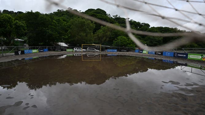
Image 2 of 4View of a beach football field flooded after heavy rains in Santiago Texacuangos, El Salvador, on June 21, 2024. Torrential rains across Central America have left at least 27 dead in landslides and flooding over the past week, mainly in El Salvador, but also in Guatemala and Honduras, officials said Friday. (Photo by MARVIN RECINOS/AFP via Getty Images)
![Central America flooding]() Image 3 of 4
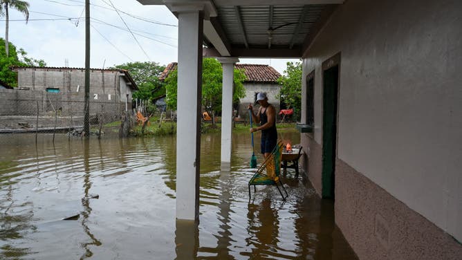
Image 3 of 4A man stands outside a flooded house in El Cubulero community, La Alianza municipality, Valle department, Honduras, on June 21, 2024, after the overflowing of the Goascoran river due to heavy rains. Torrential rains across Central America have left at least 27 dead in landslides and flooding over the past week, mainly in El Salvador, but also in Guatemala and Honduras, officials said Friday. (Photo by El Salvador Government/Anadolu via Getty Images)
![Central America flooding]() Image 4 of 4
Image 4 of 4View of the flooding of the Goascaran river in El Cubulero community, La Alianza municipality, Valle department, Honduras, on June 21, 2024, after heavy rains. Torrential rains across Central America have left at least 27 dead in landslides and flooding over the past week, mainly in El Salvador, but also in Guatemala and Honduras, officials said Friday. (Photo by Orlando SIERRA / AFP) (Photo by ORLANDO SIERRA/AFP via Getty Images))

Forecast for tropical disturbance 93L
Due to the limited time the disturbed area of weather will spend over water, its chances of developing are lower than what Alberto experienced less than a week ago.
Water temperatures remain warm, enhancing tropical cyclone formation. However, the system's apparent large size means it will take longer to consolidate.
Computer forecast models show the tropical disturbance moving ashore on the Mexican coast Sunday night, whether a low-level center develops or not.
2024 ATLANTIC HURRICANE SEASON GUIDE: HERE’S WHAT TO KNOW ABOUT THIS YEAR’S STORMS
Heavy rainfall will accompany the system, which is welcome news to many farmers and aquifers in the agricultural region.
In the higher mountainous areas, torrential rainfall can cause problems, as happened during Tropical Storm Alberto.
Mexico's civil protection agency reported at least four people died during the storm, with the majority from electrical shocks from downed power lines.
(FOX Weather)
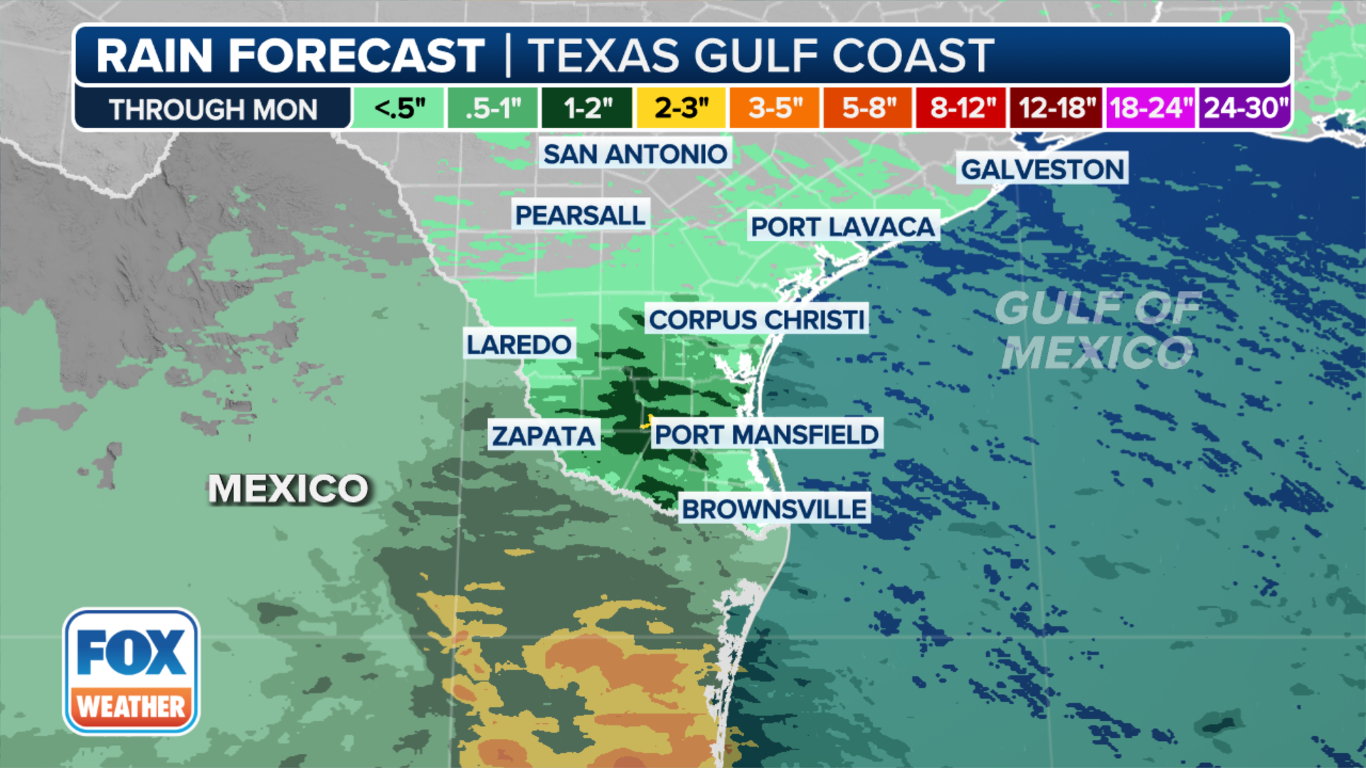
"Areas like Brownsville and Port Mansfield that got soaked from Alberto could easily, with this one, pick up another 2 to 3 inches plus of rain," Oliver said.
If the disturbance gains enough organization to be classified as a tropical storm, it will be named Beryl.
The naming of the system would not change the forecast or outcome for either Mexico or Texas.
Typically, the second named storm does not form in the Atlantic Basin until July 17.
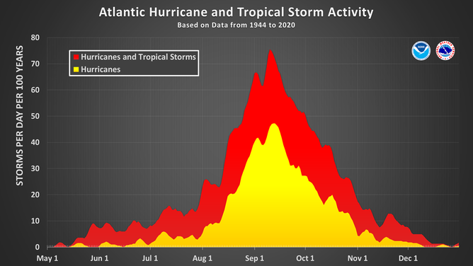
This chart shows the amount of tropical cyclone activity, in terms of named storms and hurricanes, that occurs in the Atlantic Basin on each calendar day between May 1 and Dec. 31. Specifically, it shows the number of hurricanes (yellow area) and the combined named storms and hurricanes (red area) that occur on each calendar day over a 100-year period.
(National Hurricane Center / NOAA)